Service Blueprints to Align Teams on User Needs
Service Blueprints to Align Teams on User Needs
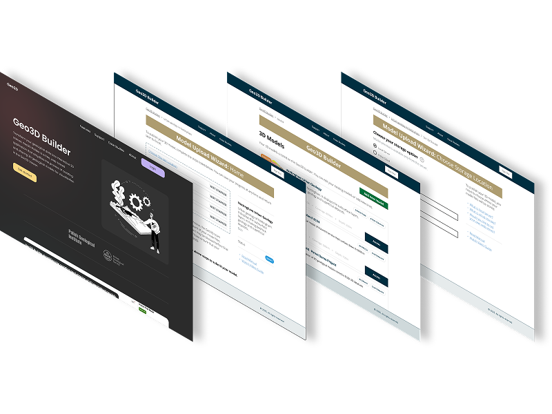
 PROJECT LINKPROJECT LINK
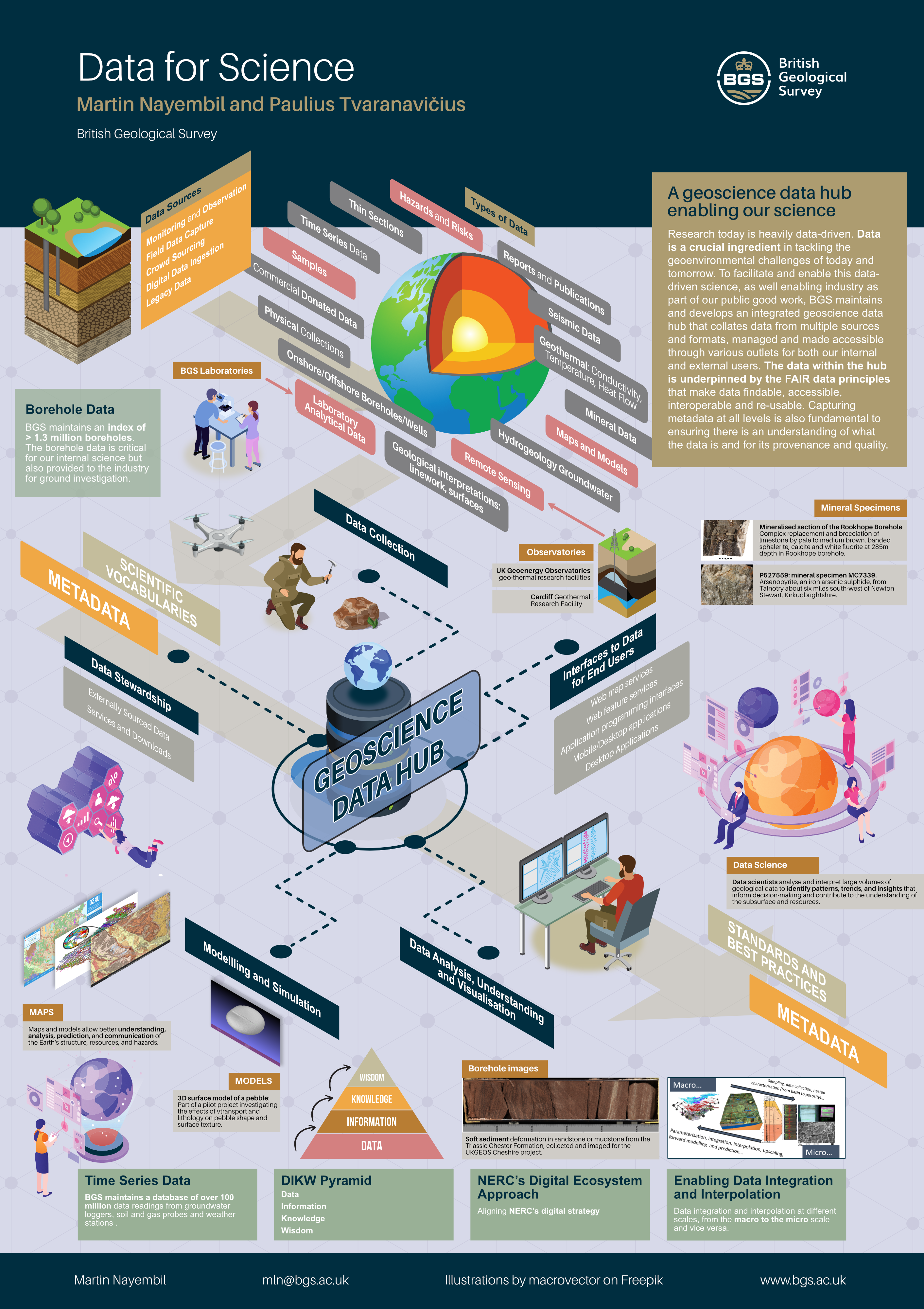
I collaborated with the Head Data Architect and Head of Digital Mapping to produce posters and service blueprints illustrating the extensive data landscape at BGS. These visuals showcased how we harness data to address present and future geoenvironmental challenges.
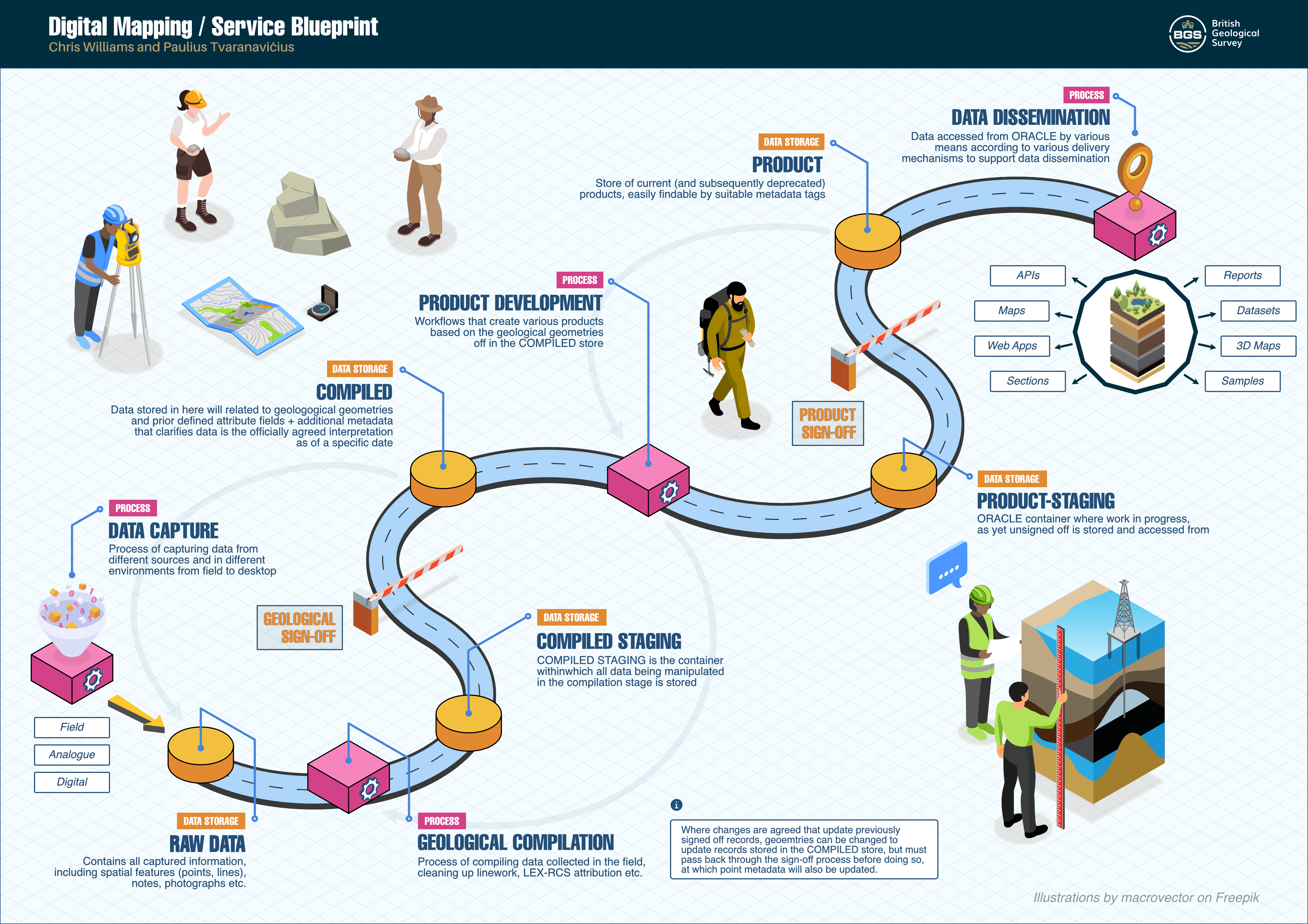
To guarantee the efficient and precise capture, storage, and processing of our data, it's esential that every department aligns on the associated processes and procedures. Achieving this requires a holistic, systems-oriented approach, examining the entire workflow from start to finish.
Additionally, I created a more thorough and detailed Service Blueprint that identifies opportunities and challenges at different stages of the data capture process. This map proved invaluable to field geologists, the informatics team, the products team, and others involved in the process by highlighting bottlenecks and areas for improvement.

Created a visual workflow representation that clearly communicates the complex Spatial Data Delivery Service (SDDS) process.
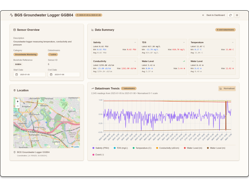
This case study demonstrates how user-centered design, rapid prototyping, and modern development tools can transform complex environmental data into accessible, actionable insights for diverse user groups.
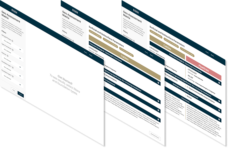
The offshore wind industry needed a simplified, accessible tool to compare geological features for foundation siting decisions. Existing geological assessment data was locked in complex Excel spreadsheets, making it difficult for wind farm developers to quickly evaluate and compare site conditions across different geological environments.
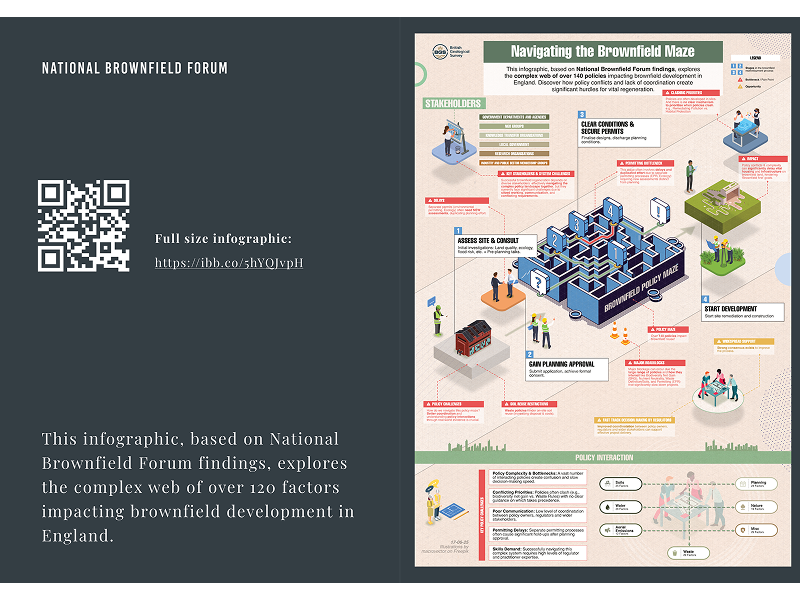
Transforming dense policy research into engaging, actionable insights for government stakeholders and industry professionals