Geo-Assessment Matrix: Decision Support Tool for Offshore Wind Development
Geo-Assessment Matrix: Decision Support Tool for Offshore Wind Development
 PROJECT LINKPROJECT LINK
1. User Research & Requirements Gathering
2. Requirements Analysis
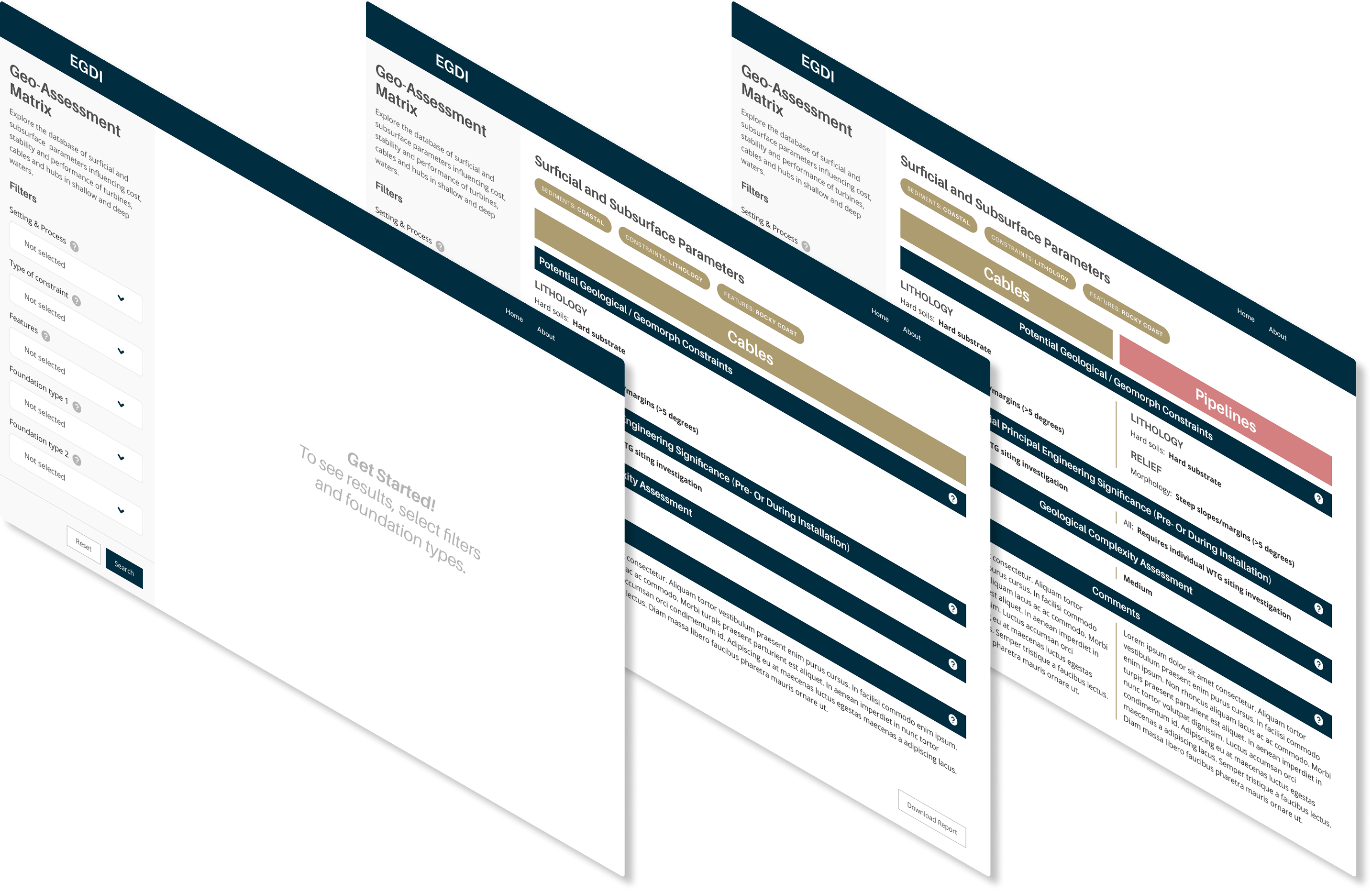
3. Prototyping & Design
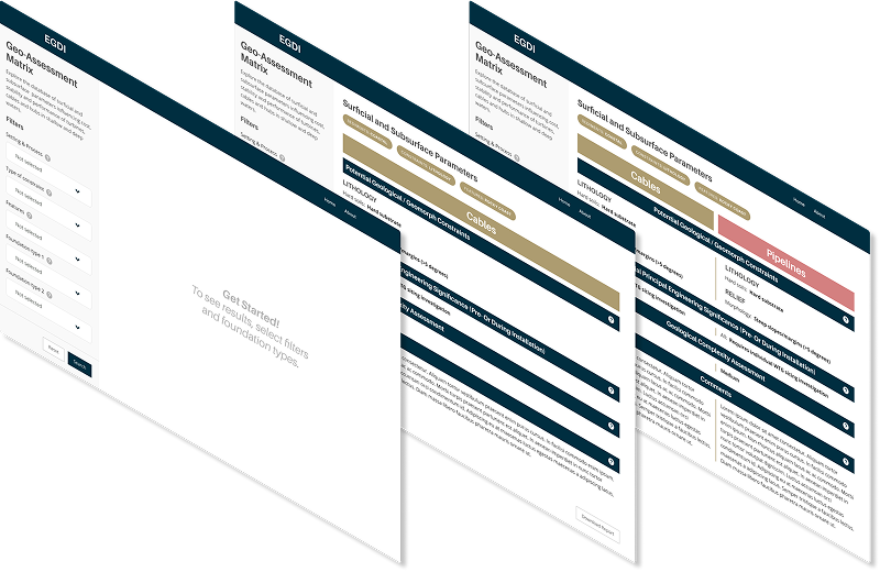
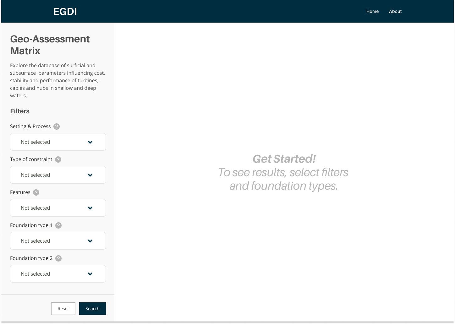
Core Functionality
User Value
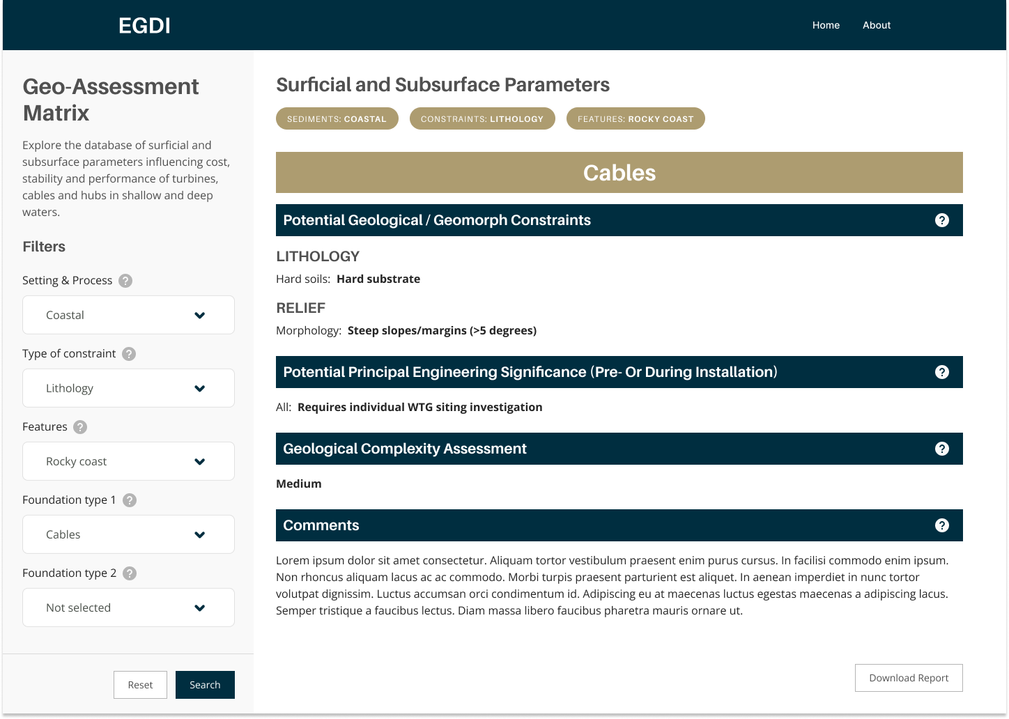
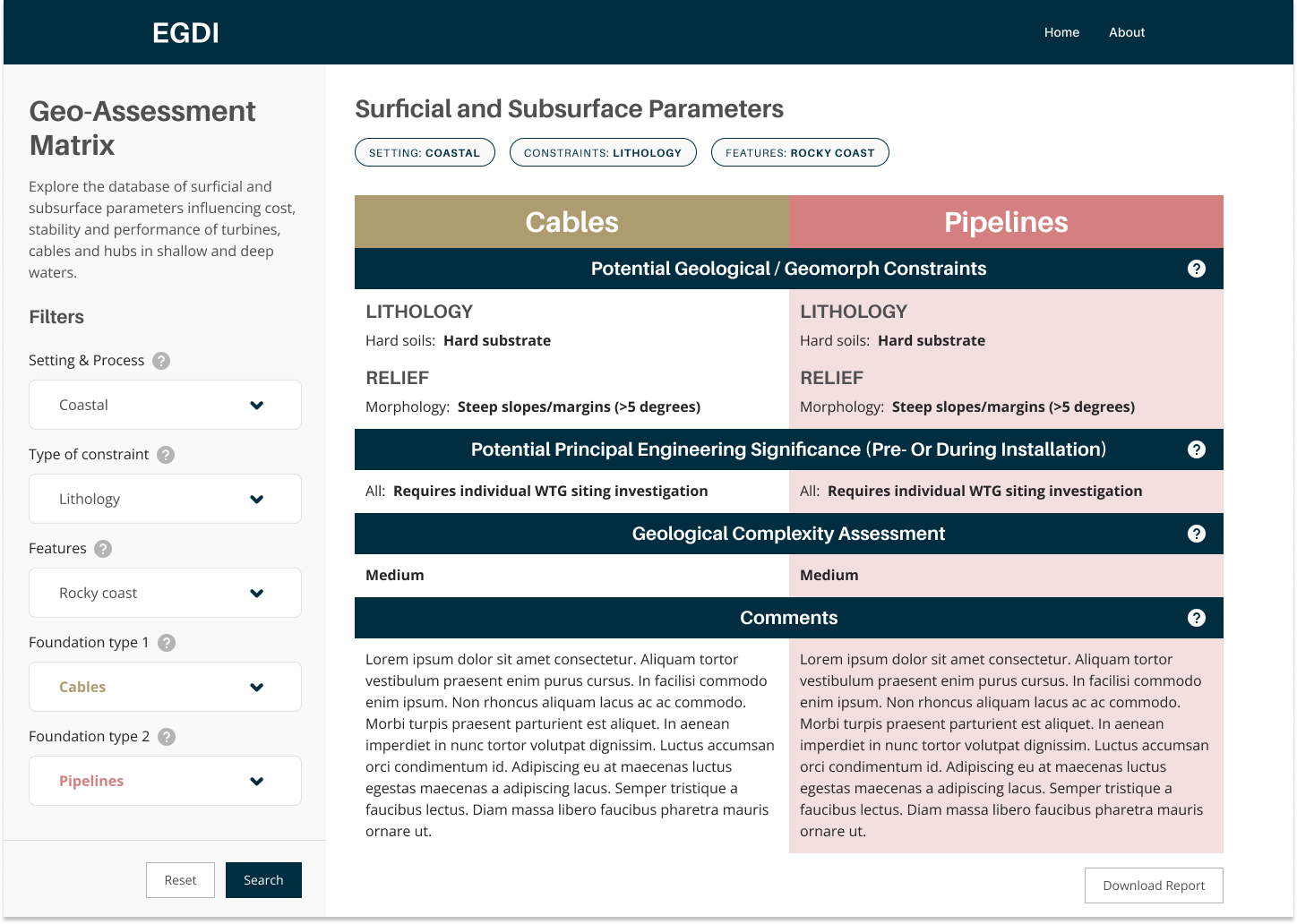
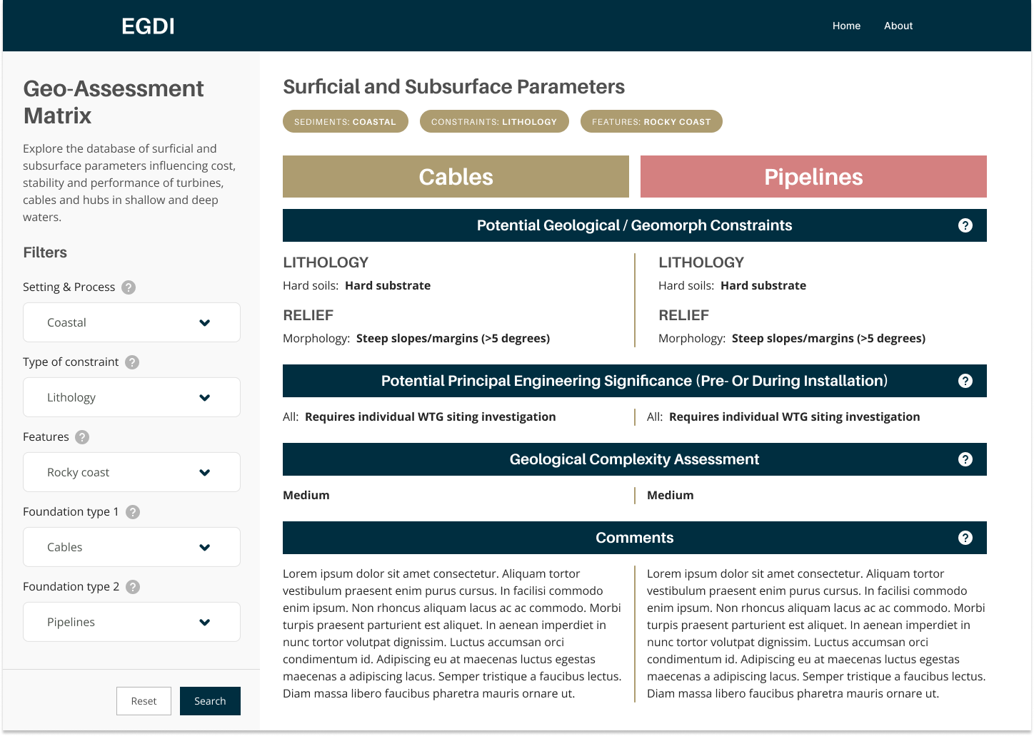
The tool transformed complex geological data from Excel spreadsheets into an intuitive web interface accessible to non-specialists. Assessment workflows that previously took hours now take minutes, enabling faster decision-making during critical project phases.
By democratizing geological expertise, the tool allows engineers and project managers to quickly evaluate foundation suitability across different geological conditions, improving the quality and speed of early-stage site assessments for offshore wind projects.
%201.png)

Created a visual workflow representation that clearly communicates the complex Spatial Data Delivery Service (SDDS) process.
This case study demonstrates how user-centered design, rapid prototyping, and modern development tools can transform complex environmental data into accessible, actionable insights for diverse user groups.
The offshore wind industry needed a simplified, accessible tool to compare geological features for foundation siting decisions. Existing geological assessment data was locked in complex Excel spreadsheets, making it difficult for wind farm developers to quickly evaluate and compare site conditions across different geological environments.
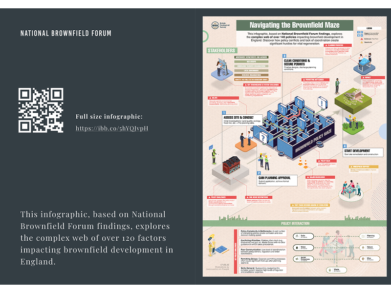
Transforming dense policy research into engaging, actionable insights for government stakeholders and industry professionals