Multi-Organisation Content Management System for Hazard Data
Multi-Organisation Content Management System for Hazard Data
 PROJECT LINKPROJECT LINK
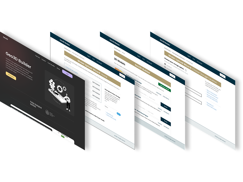
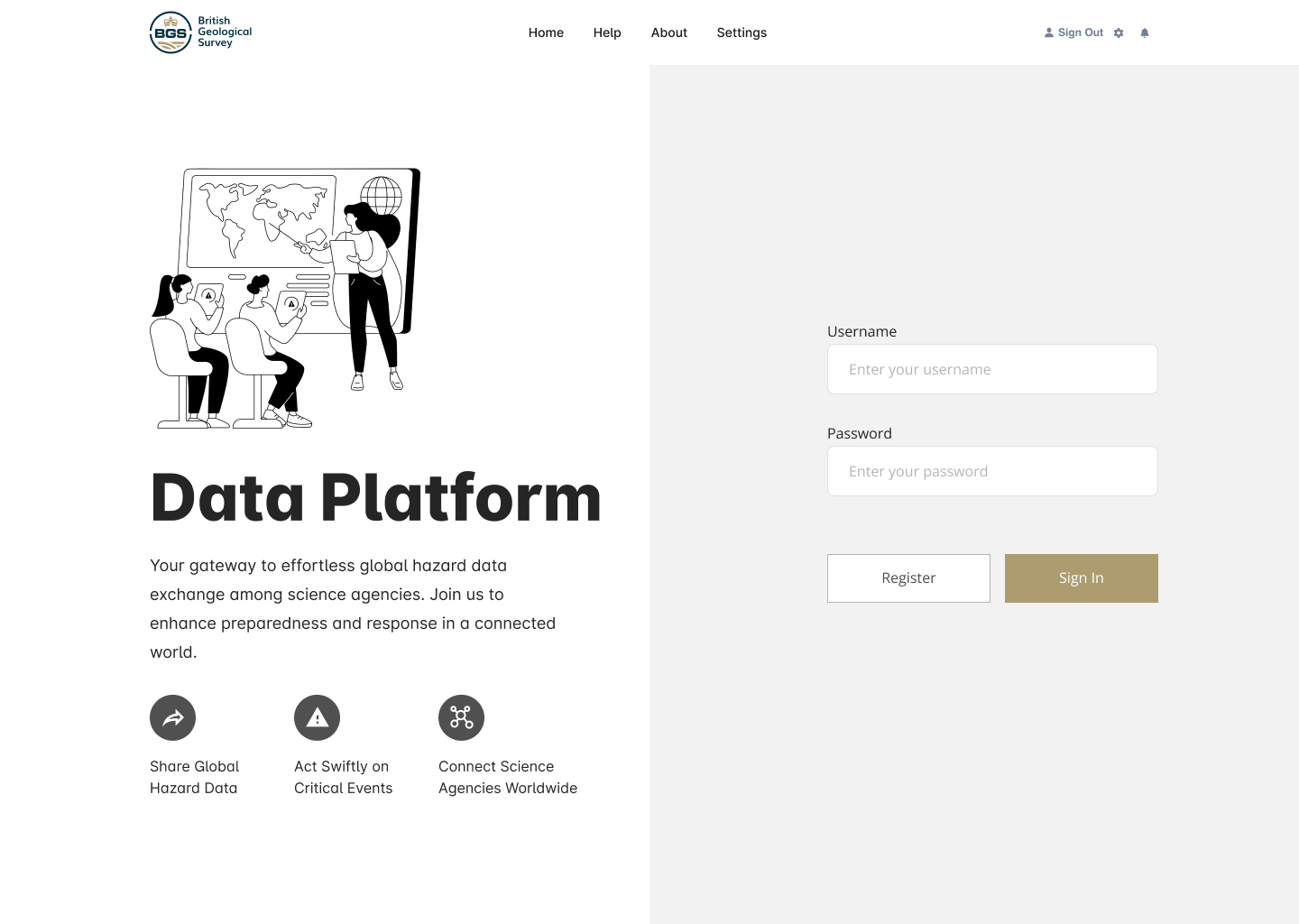
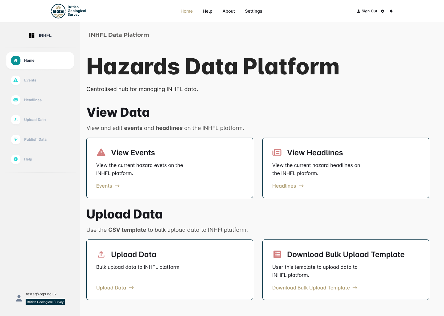
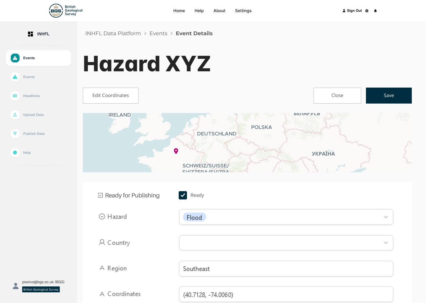
In 2023, I played a key role in developing a platform that streamlines global hazard monitoring. I designed the initial prototype and spearheaded a user testing phase with stakeholders from various science agencies.
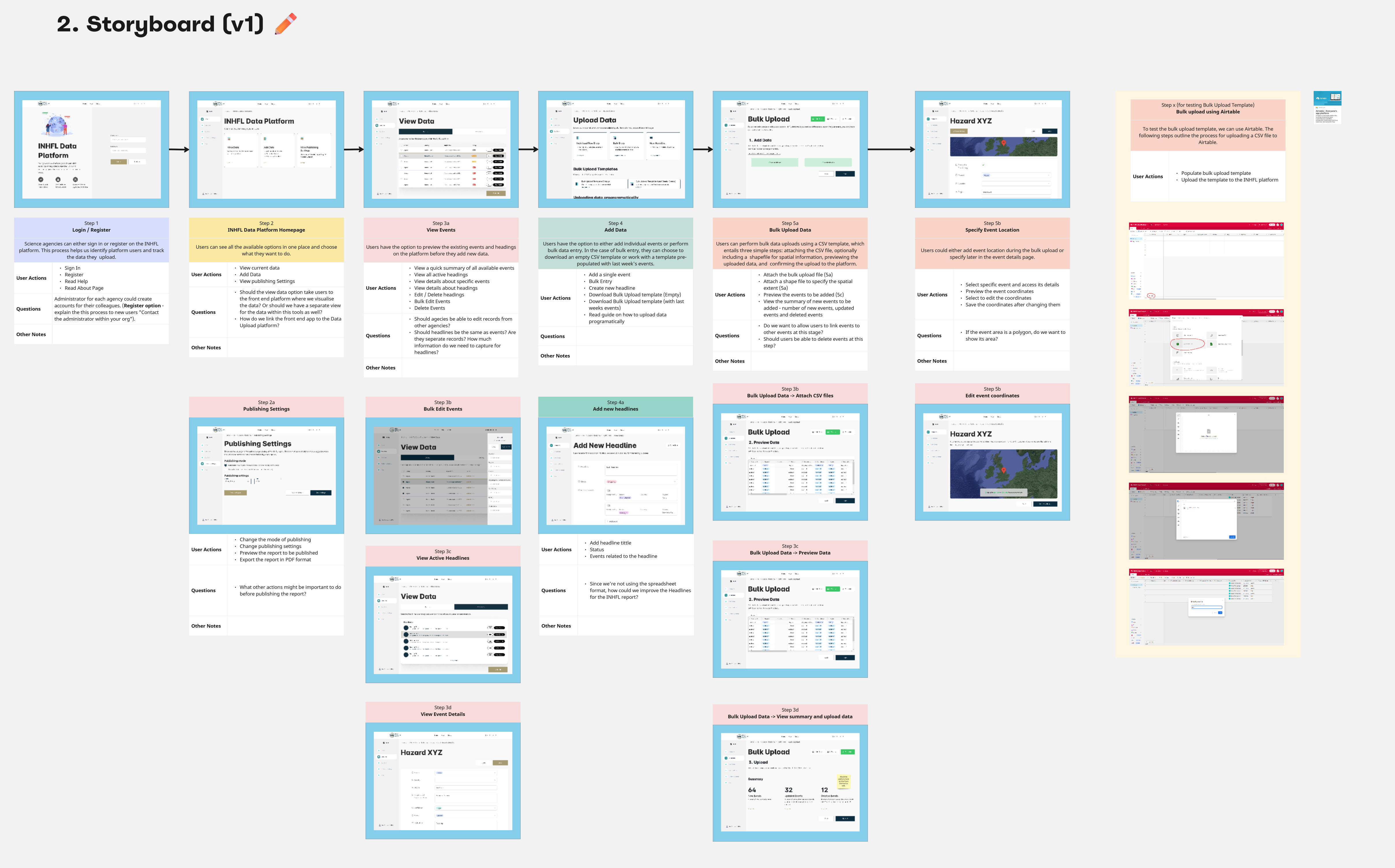
Ideation & Visualisation: During the initial design sprint, I facilitated sketching and storyboarding exercises. This fostered collaborative brainstorming and allowed us to rapidly explore a broad range of potential solutions.
Prototyping: Moving from rough concepts, I developed more detailed prototypes. These provided increasing levels of interactivity, offering a tangible look and feel during user testing.
User Testing: To glean crucial insights, I conducted a mix of in-person and remote user testing sessions. Employing the Useberry platform expanded our reach and broadened participation.
Insights & Recommendations: I thoroughly reviewed user testing findings, identified actionable patterns, and created data-backed recommendations for the platform's next iteration.
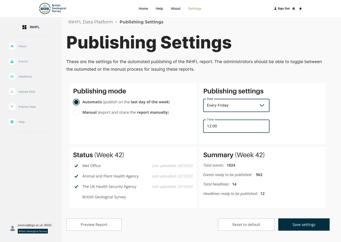
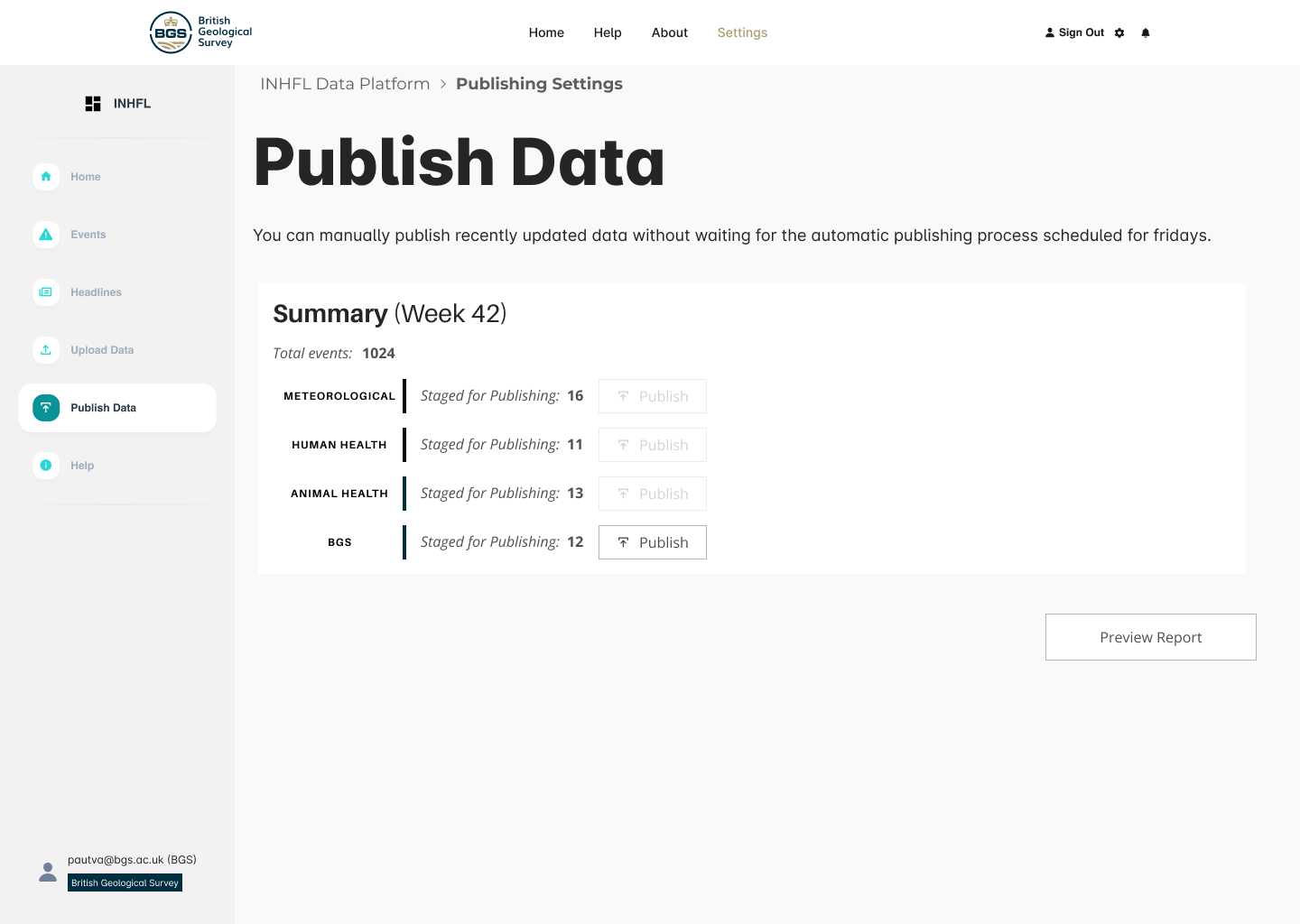
Requirements Gathering: These recommendations provided the backbone for drafting a comprehensive product requirements document. This essential document established clear objectives and technical specifications for the platform's development.
Overall, users find the prototype promising, valuing its design and potential. However, feedback underscores several key areas for refinement, including the need for greater clarity in labeling and hazard summaries, links to external resources for broader context, and tools for exporting data and customising the user experience according to specific needs.
This highlights the importance of continuous iteration and incorporating user feedback throughout development to ensure the platform delivers maximum value to those in hazard monitoring and response. The early prototyping and user feedback process will significantly save development time by answering critical questions upfront.

Created a visual workflow representation that clearly communicates the complex Spatial Data Delivery Service (SDDS) process.
This case study demonstrates how user-centered design, rapid prototyping, and modern development tools can transform complex environmental data into accessible, actionable insights for diverse user groups.
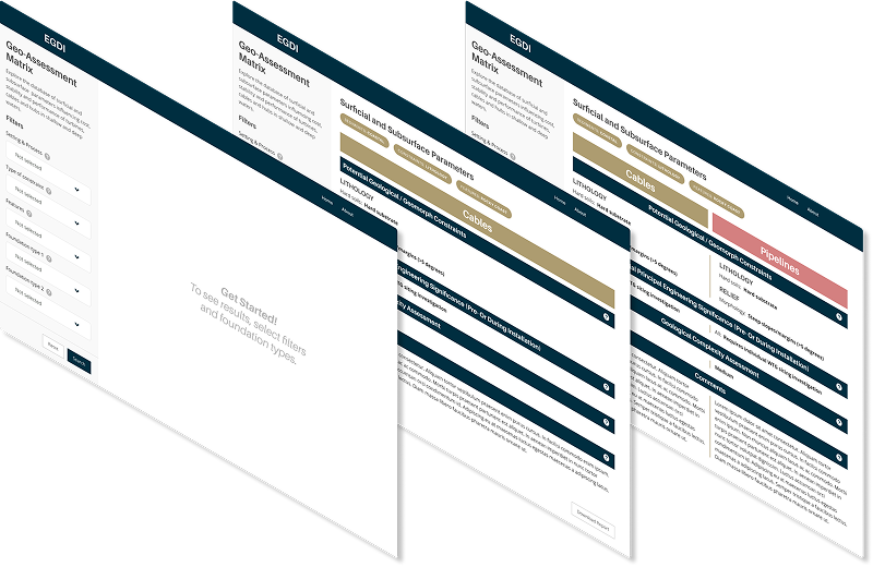
The offshore wind industry needed a simplified, accessible tool to compare geological features for foundation siting decisions. Existing geological assessment data was locked in complex Excel spreadsheets, making it difficult for wind farm developers to quickly evaluate and compare site conditions across different geological environments.
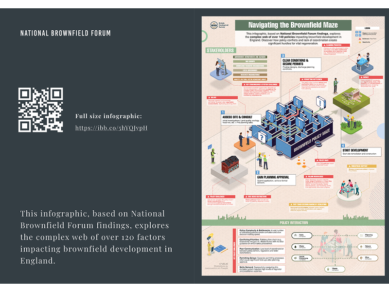
Transforming dense policy research into engaging, actionable insights for government stakeholders and industry professionals