Enhancing Geospatial Data Portals: Wireframes, Design Guidelines, and User Insights
Enhancing Geospatial Data Portals: Wireframes, Design Guidelines, and User Insights
 PROJECT LINKPROJECT LINK
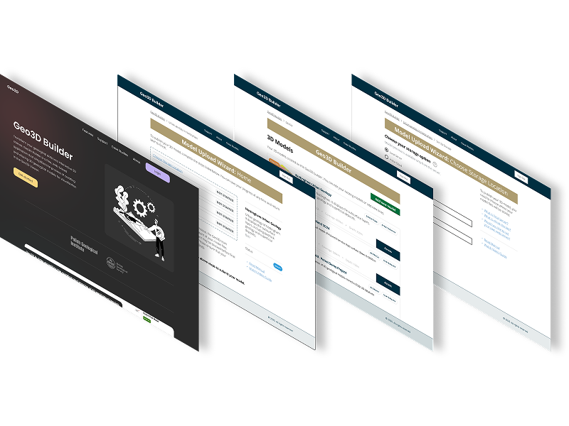
I worked on the Data Discoverability 2 and 3 to create wireframes and design guidelines for geospatial data portals.
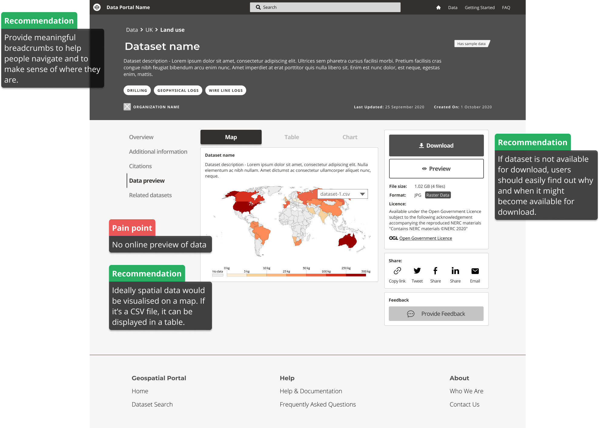
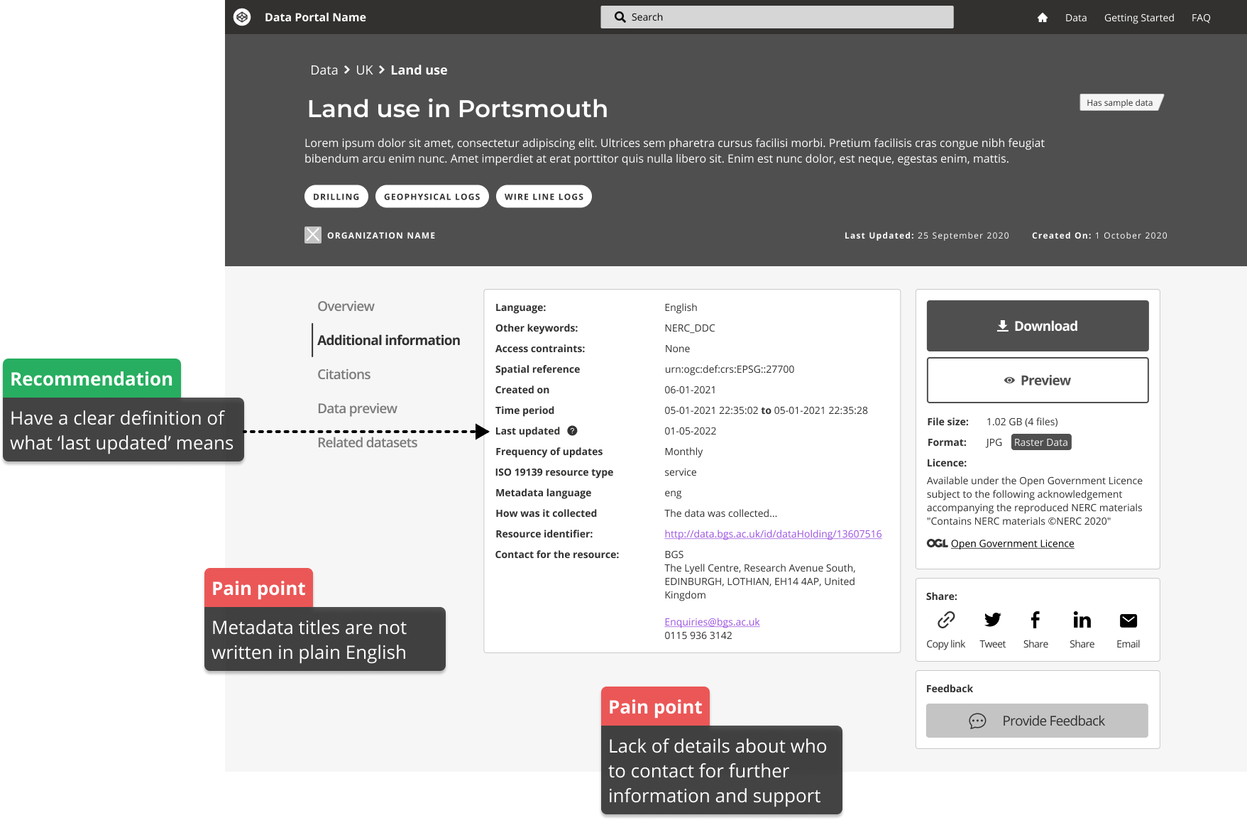
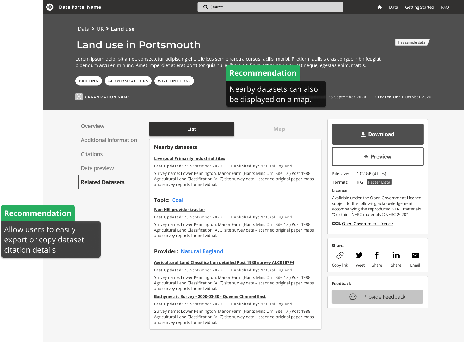
The purpose of my work in this project was to assess the requirements of users when they search for and access spatial data through data portals. I evaluated the effectiveness of meeting these needs and proposed recommendations to enhance the landscape of data portals in the UK, ultimately improving the success rate of users in finding and accessing spatial data.
This improvement has the potential to result in significant time and cost savings for businesses, research institutes, organizations, charities, and the general public when it comes to searching for and generating data, by ensuring that data portals are consistently designed and provide easy access to datasets through web-based interfaces based on comprehensive metadata records that describe the datasets and offer guidance on their location and usage restrictions.
The design guidelines have been published on BGS GitHub and can be accessed here:
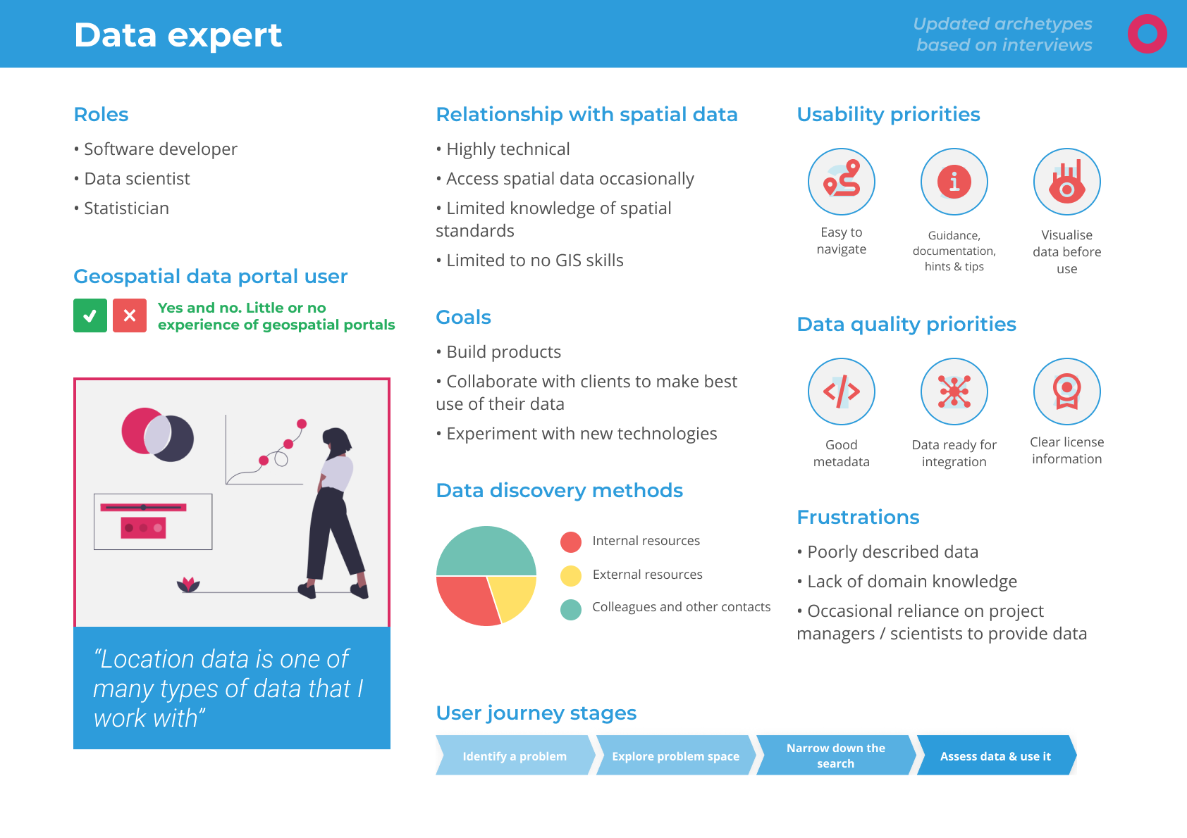
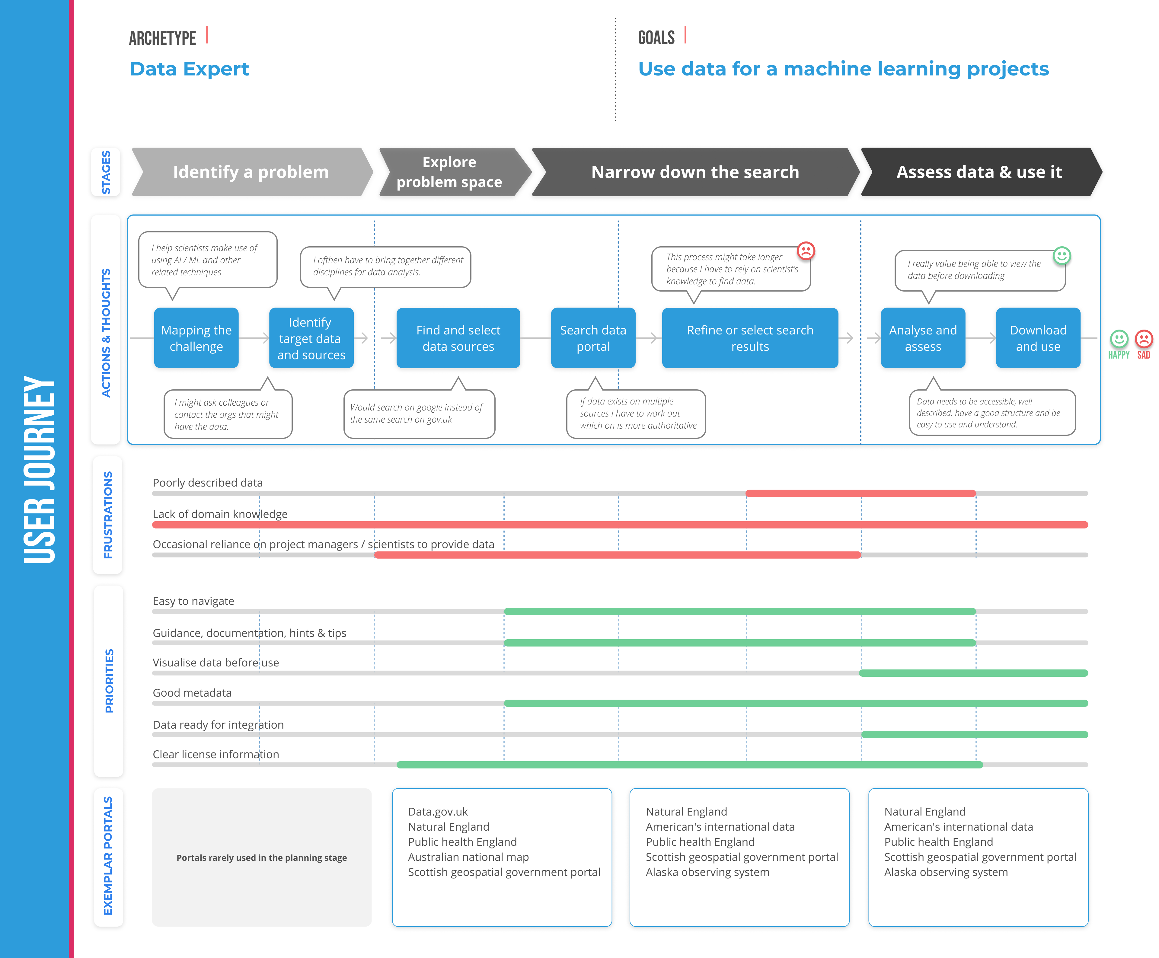
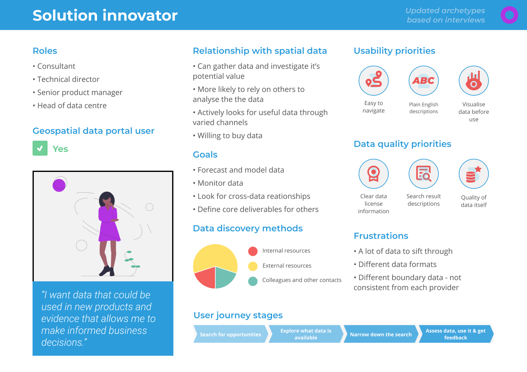
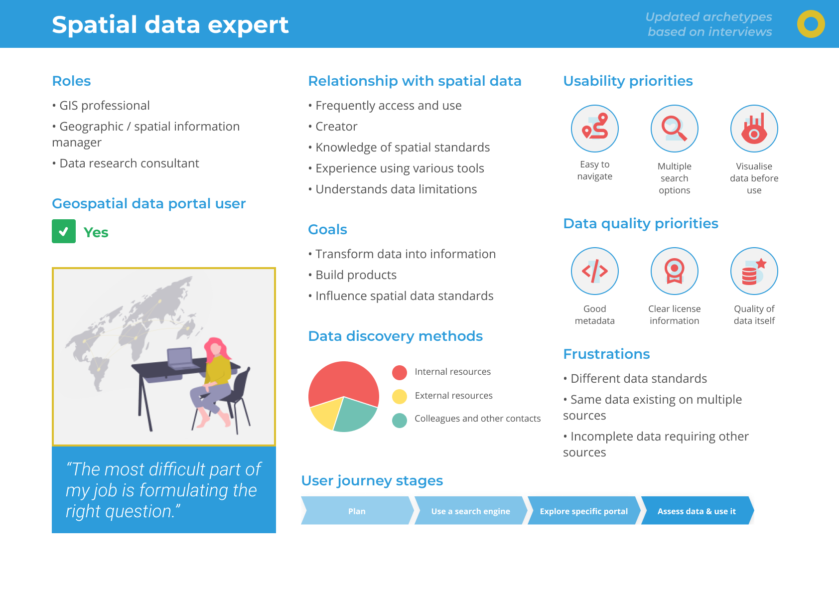
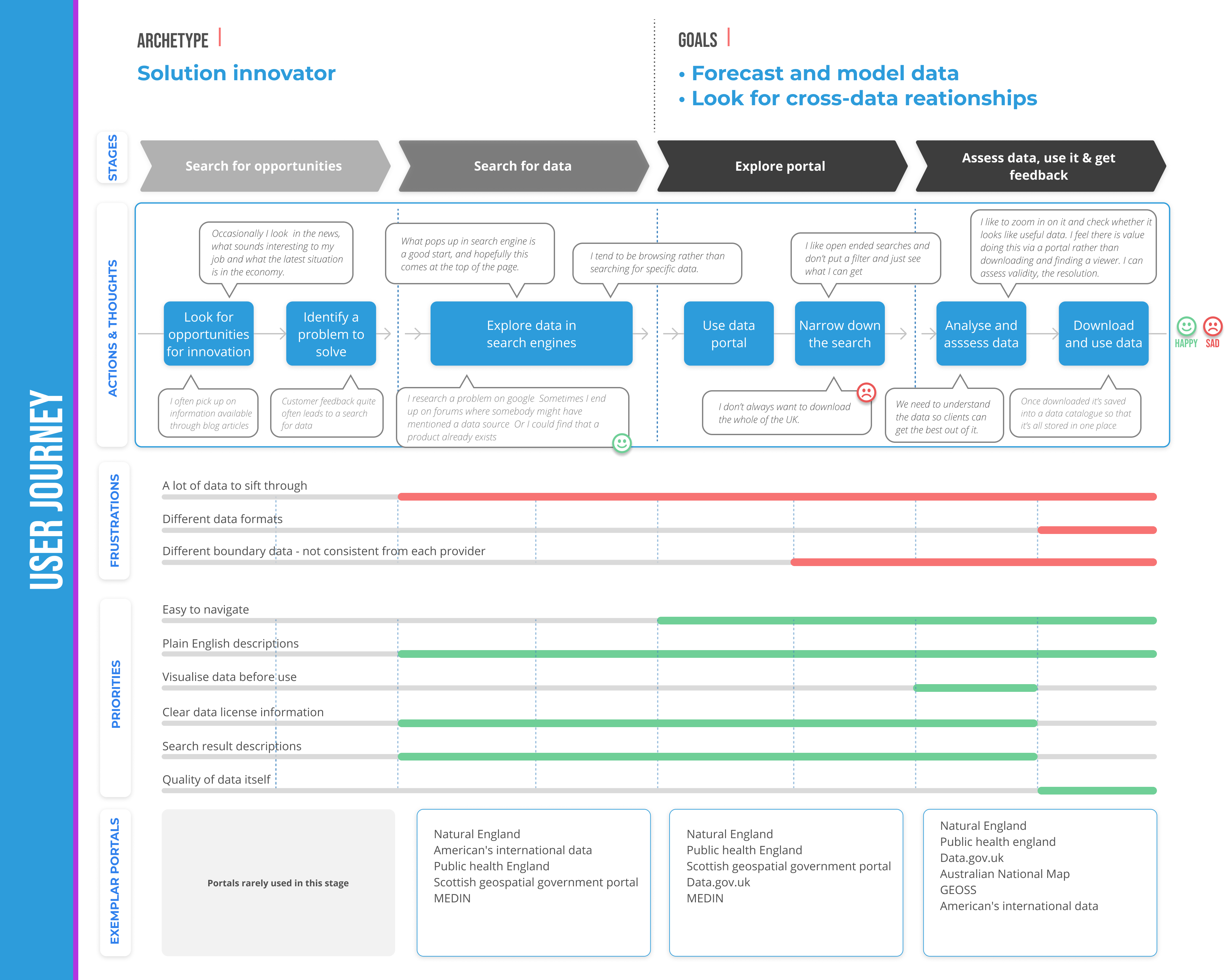
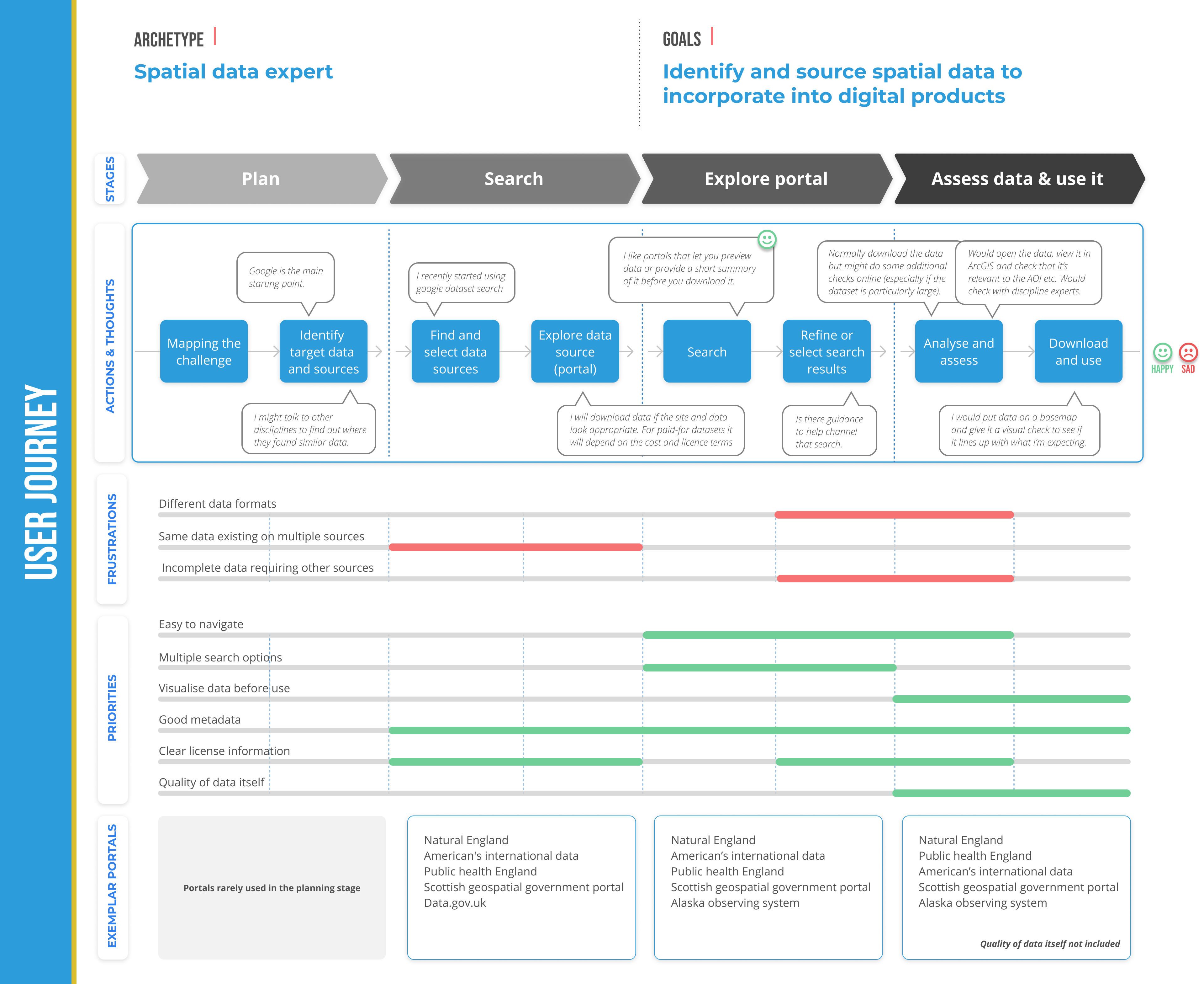
I've crafted personas and user journeys by combining insights from various interviews we conducted with geospatial data users, simplifying our research findings into clear user representations and their typical experiences.
We have identified these 6 key archetypes of users who rely on geospatial data:


Created a visual workflow representation that clearly communicates the complex Spatial Data Delivery Service (SDDS) process.
This case study demonstrates how user-centered design, rapid prototyping, and modern development tools can transform complex environmental data into accessible, actionable insights for diverse user groups.
The offshore wind industry needed a simplified, accessible tool to compare geological features for foundation siting decisions. Existing geological assessment data was locked in complex Excel spreadsheets, making it difficult for wind farm developers to quickly evaluate and compare site conditions across different geological environments.
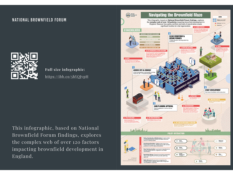
Transforming dense policy research into engaging, actionable insights for government stakeholders and industry professionals